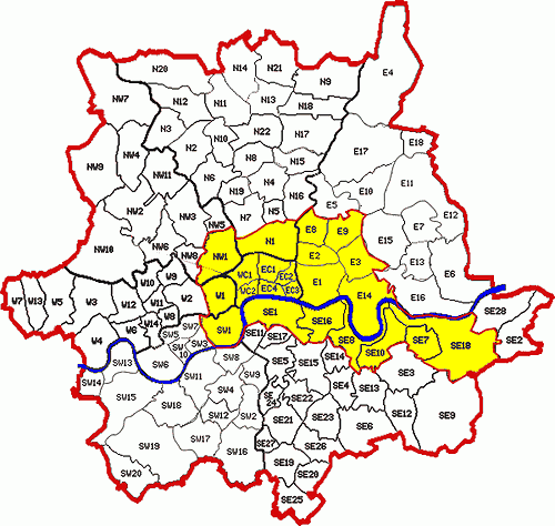
The WC (Western Central) postcode area, also known as the London WC postcode area, is a group of postcode districts in central London, England. The area covered is of high density development, and includes parts of the City of Westminster and the London Boroughs of Camden and Islington, plus a very small part of the City of London.
The WC1 and WC2 postcode districts are relatively recent, having been established in 1917. When the districts are used for purposes other than the sorting of mail, such as for geographic reference and on street signs, their subdivisions - featuring letter suffixes - are often omitted.
Postal administration
WC1 and WC2 postcode districts are part of the London post town. Until created in 1917 they comprised the WC postal district. There are no postally-recognised localities used in them. No great recoding in this postcode area took place from 1990 to 2007.
Post Offices in WC1 are at Grays Inn, Marchmont Street, Southampton Row, at High Holborn and nearby parallel New Oxford Street and in the other clustered at Aldwych and Strand. The Western Central District Office was on New Oxford Street, a stop on the underground London Post Office Railway. Deliveries for the area come from Mount Pleasant Mail Centre, west of Farringdon Road.
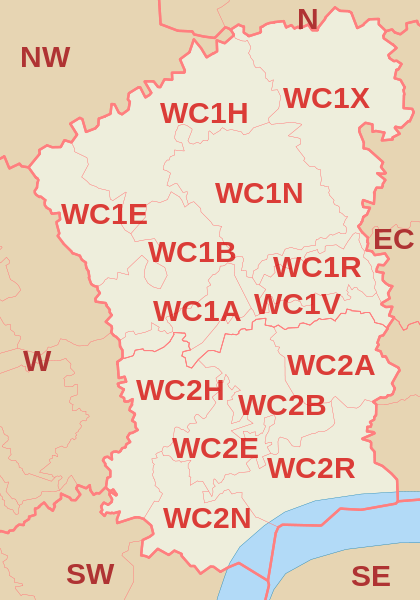
List of postcode districts
The postcode districts are, with approximate coverage:
Boundaries
Map
See also
- Postcode Address File
- List of postcode areas in the United Kingdom
- London postal district
- Central London
- West End of London
References
External links
- Royal Mail's Postcode Address File
- A quick introduction to Royal Mail's Postcode Address File (PAF) Archived 26 September 2018 at the Wayback Machine